


On the day before my departure from the United Kingdom, Sam and I joined his parents on a health-giving walk in Snowdonia National Park. 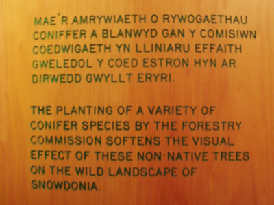 On our way back to the car we stopped at the park's visitor center, the first such interpretive center I've ever visiter outside the United States or Canada. It was... well, it was somewhat informative, but that's about the best I could say for it. Then again, the general philosophy of Parks Canada and the US National Park Service, do, I think, differ greatly from the philosophy of park management in the United Kingdom, so it's perhaps to be expected that the exhibits would do little more than convey information. 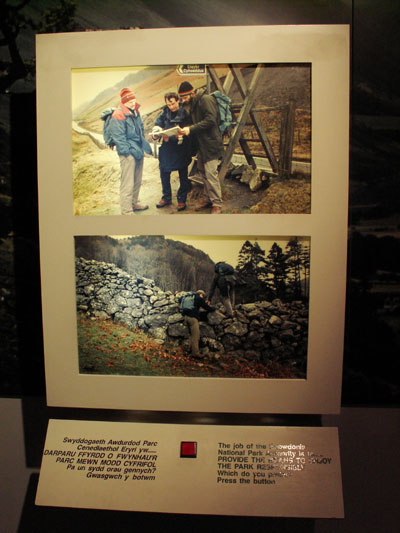 This sign was one of my favorites. A state of the art light-up push-button display, you would be given two options and asked which you prefer. You would push a button, and one of the two signs would light up to tell you which one you prefer. No explanation as to why one is better than the other. I think they thought this would be obvious, but that was not always the case. Most of the exhibits fell into two groups: those that just told you facts about the resources, and those that preached to you but didn't give you a good reason to think about changing your point of view if you disagreed with the management strategy in question. 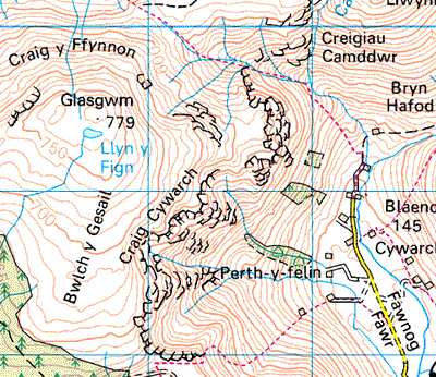 This is a map of the area we hiked. I show it only to give you an idea of the terrain. I should have perhaps traced our route on this map, because very little of our route (less than half) is already on here. But basically we walked the dotted red line that leads north from the end of the yellow road. At some point we left that path and took another path which isn't marked on this map, toward Llyn y Fign - the tiny lake on the mountaintop. We then took a path southeast, down through the cliffs and back to where we started. 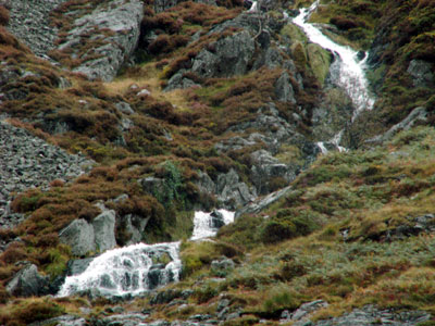 We followed the stream for the first little bit. Due to the terrain and generally rainy nature of the area, there were little cascades all over the place. 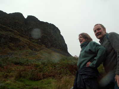 Here's a photograph of Miranda and Mash that I took on one of our short but numerous breaks. It gives you a pretty good idea of the terrain, I think. 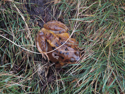 (Rana temporaria). 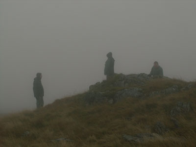 As we approached the top of the ridge, we found ourselves very much in the clouds. Here is a photograph of the Ashwells uptrail of me in the mist: Sam on the left (carrying food in the belly pocket of his fleece top - pretty much the most unflattering place to keep your apricots), Miranda in the middle, Mash on the right. 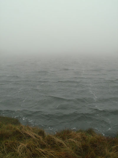 And then we found the lake, Llyn y Fign. Sam was pretty dismayed that I couldn't hold back comments on how much it reminded me of entering Avalon. 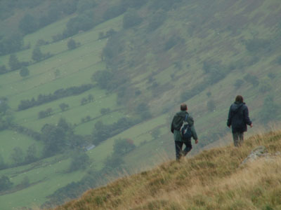 With the clouds lifted, we were able to negotiate the cliffs safely and make our way down in a different direction than we'd come.  A rock cairn on an adjacent ridgeline. 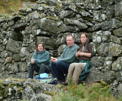 We took a lunch break at the ruins of a shepherd's house. 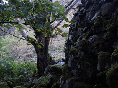 At this point we were sort of off the beaten path. As in, there wasn't much path. But Mash knows the land owners here, and had hiked down this ridge many times in the past. Problem is, sheep are no longer grazing on this portion of the hill, and it's really grown up with brambles, heather, and bracken. Gorgeous, delicious perhaps, but difficult to navigate without getting torn to shreds; poor Mash broke trail, and I think he ended up with more than a few thorns and cuts. 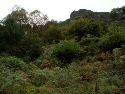 View upslope, through the undergrowth toward the cliffs above. 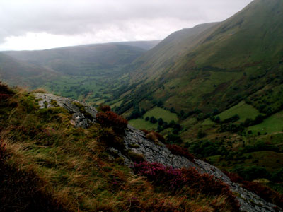 And the view of the Cywarch Valley that stretched out before us. 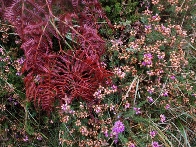 We might have cursed how the bracken and thorns caught our feet and tried to send us tumbling downhill, but the autumn colors were amazing to behold. 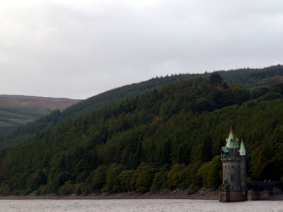 The straining tower, where fresh water is filtered 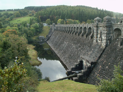
And the back side of the Lake Vyrnwy dam:
|
